
Here’s why you should screen your portfolio for flood risk with EarthScan

By Cervest

Last month, a report by the World Meteorological Organization highlighted a fivefold increase in climate-related disasters over the last decade – totaling a hefty cost of USD200 million a day. Extreme weather events are clearly on the rise and show no signs of slowing down, as climate change takes its toll on our planet. Floods in Bangladesh and Pakistan, heatwaves and droughts throughout Europe, wildfires in California: the climate crisis is a matter of urgency and inaction just isn’t an option.
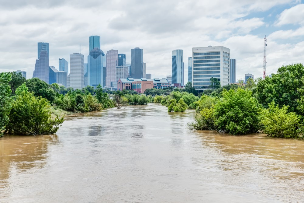
In some locations, climate change will mean more frequent flooding events that might reach greater water depths, last longer or impact further inland. We have previously highlighted flood risk across San Francisco in a visualization, and in our 3D image highlighting how thousands of buildings in Dublin are at risk of coastal flooding by 2100. The utter devastation and cost of flooding to our economy is huge: a Reuters article says that at least 1,000 people have been killed during the Pakistan floods and that they will cost at least USD10 billion.
What is flooding?
Flooding is defined in the Oxford Dictionary as: “Large amounts of water covering an area that is usually dry”. When looking at climate hazards, flooding is one of the most prevalent. It can overwhelm physical buildings and severely impair core infrastructure – the financial loss for organizations is high. No organization wants to experience flooding and its aftermath.
What are the different types of flooding?
Different types of flooding include coastal flooding, riverine flooding, and pluvial flooding. Coastal flooding happens when the local sea level rises along the coastline. Coastal flooding can occur very suddenly, making it extremely dangerous. The most extreme coastal flooding is due to storm surges – causing a short-term increase in sea levels. Flatter coastal areas with minimal flood defences are often most affected.
Riverine flooding happens when snowmelt or heavy rainfall over an extended period of time, causing rivers to exceed their capacity and overflow onto dry land. Damage from riverine flooding can be widespread, as overflow impacts the river system downstream, causing smaller rivers also to overflow. This means riverine flooding can impact large areas and create significant economic damage. Pluvial flooding happens when land surfaces can’t absorb local rainwater. Although pluvial floods can be just a few inches deep, they can occur unexpectedly and quickly, which means that they can be very dangerous.
Climate change and flooding
With the inevitable rising of sea levels in the future, coastal flooding is set to swell. This not only means an increased frequency in coastal floods but, ones that have higher water levels, flood further inland, and have a longer duration. Riverine flooding is starting earlier than ever due to snowmelt and global hydrological models show that the areas that will be impacted by floods are growing. Then, there are compound flooding events. Sometimes high precipitation and extreme sea levels happen together, directing water into low-lying areas – this can have more destructive consequences.
How does flooding impact infrastructures?
There are many impacts of flooding on physical buildings and core infrastructures. Building materials and structures can be severely damaged – depending on the scale of the flood, it can totally ruin a building with irreversible structural damage. Equipment or furniture inside the building can also be damaged or destroyed and general operations shut down. Flooding can cut off site access, disrupting deliveries and preventing employees or customers reaching the site. This is just the start of the issues. When core infrastructure networks are impacted it can cause chaos. From a health perspective, overflowing sewers can alter sanitation levels including contaminating drinking water.
The cost of flooding is catastrophic: it’s not only the cleaning up but the damage to goods and the building or infrastructures that need to be fixed. And all the time, operations are closed and services dysfunctional, creating a financial deficit. Being prepared and getting adaptation measures in place to protect your asset can help mitigate the costs should a flood event hit.
EarthScan climate intelligence
How can you best protect your business assets and portfolios against flooding at scale, and identify the greatest concentration of flooding risk across your portfolio? It starts with discovering your climate risk – analyze your assets for flood risk with EarthScan™. By fusing cutting-edge Earth Science expertise, data modeling and machine learning, EarthScan enables you to screen your portfolio for either combined physical risk or specifically, flooding , and access on-demand insights at the asset level.
With the ability to access precise flooding metrics such as inundation levels at the asset level, you can use these insights across your team or clients to help plan for all of your core assets, across the board. That includes everything from the assets that you directly own or manage, right through to your supply chain and the assets that you may be looking to acquire.
Discovering flood risk in EarthScan
To quantify asset-level exposure to flood hazards, we have developed a flood modeling framework from the ground up to generate Coastal and Riverine Flooding metrics at up to 90m resolution. Our framework incorporates a wide range of data sources to build a detailed understanding of terrain (elevation and landcover), water body boundaries (seas, shorelines, estuaries and rivers) and water flows (precipitation, river discharge, storm surges and relative sea level change). The effects of climate change are included by incorporating data on sea level, storm surges and precipitation change into our flood modeling framework.
You can use EarthScan to drill down further into climate hazards, enabling you to explore how flood risk will affect your assets differently across three IPCC-aligned climate scenarios, and multiple time horizons from 1970 to 2100 in five-year time steps. You can also use return periods to discover how much the magnitude of your risk exposure to a particular climate hazard, including coastal and riverine flooding, could change for a specific portfolio or asset over time, and give you further insight into the climate value at risk (CVaR).

Understanding and acting on these insights enables leaders in Sustainability, Risk Management and Emergency Planning to report on and create risk adaptation plans, target early interventions and inform effective mitigation strategies to reduce the impact on business operations, internally and externally, in the short and long term.
Join the EarthScan™ Starter Program and start your planning against flood risk.
Share this article
Our latest news and insights
Accenture and Cervest collaborate to bring innovative solutions to clients seeking resilience amid increased climate risk
Read more
What is climate intelligence and why do businesses and governments need it?
Read more